Maps
View the growth and evolution of Bryan and Brazos County through historic cartography. Be sure to check back often, as we’ll be periodically adding new maps to the archive. Unless otherwise noted, all maps are courtesy of the Carnegie History Center or the City of Bryan.
Brazos County Maps
Click on each map for larger image
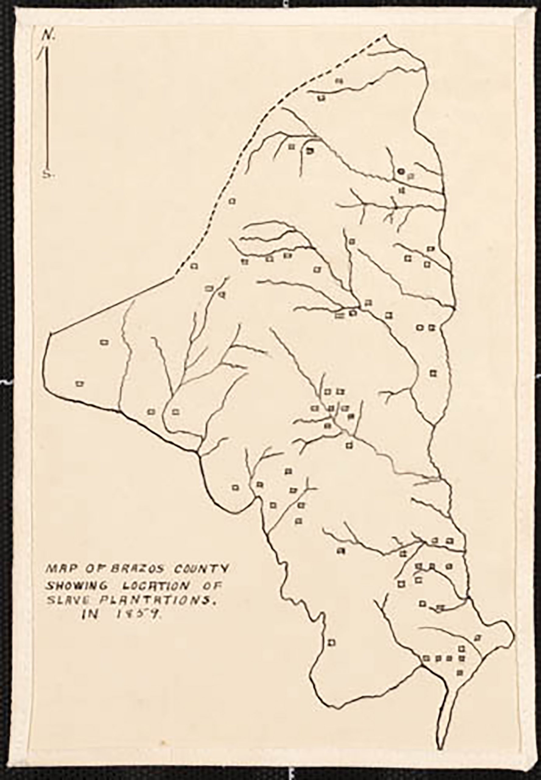
1859: Map of Brazos County showing location of slave plantations.
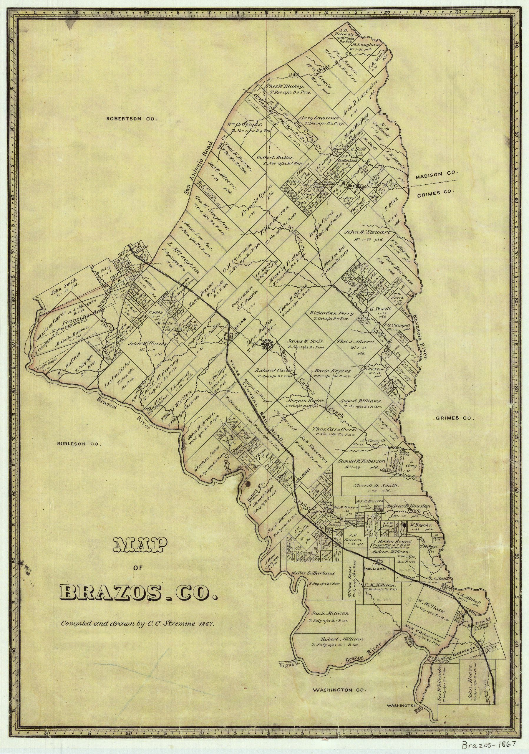
1867: Map of Brazos County compiled and drawn by C.C. Stremme in 1867. (This is a replica of the original map.)
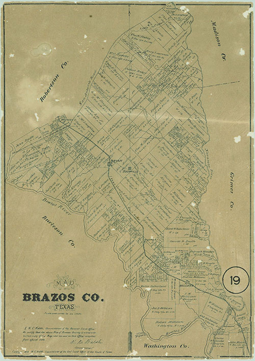
1879: Map of Brazos County from the General Land Office of the State of Texas.
City of Bryan Maps
Click on each map for larger image
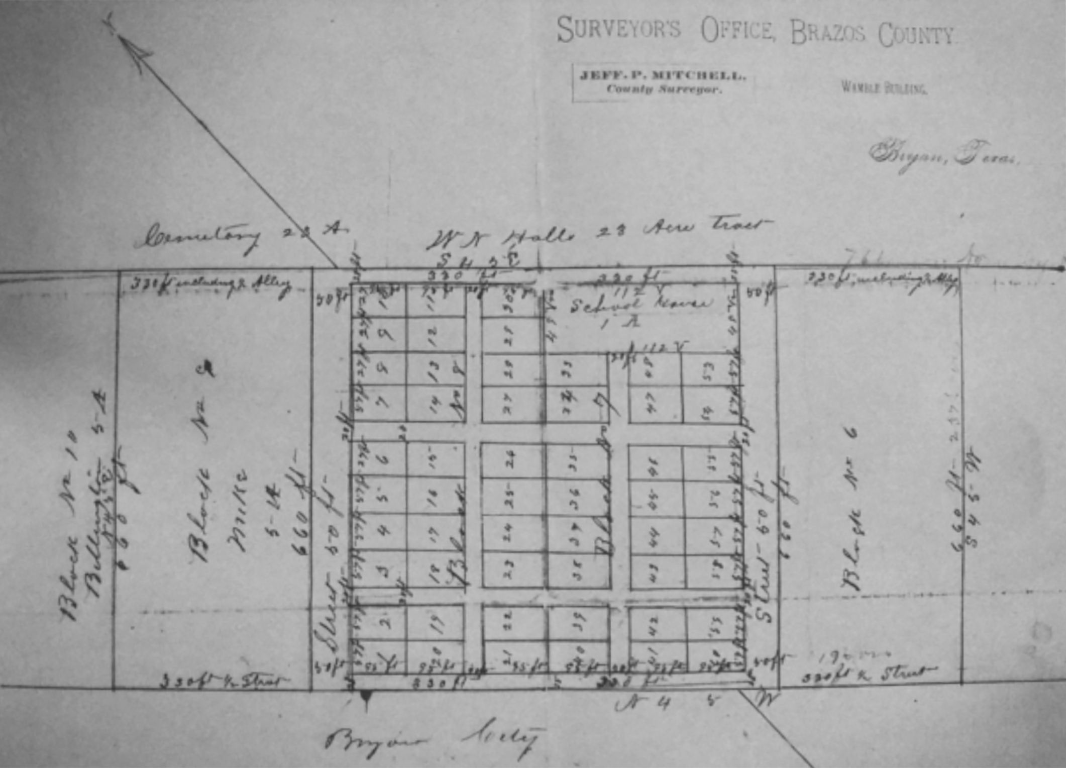
1880: Freedman Town map. Known also as Hall’s Addition (or Hall’s Division in some maps), Freedman Town was one of the earliest communities of African Americans in Brazos County after the Civil War. First land sales of lots date to 1867. It was located in blocks 7 and 8 of the “Bryan’s First Addition” area, bordering the northeastern border of the original City of Bryan townsite.
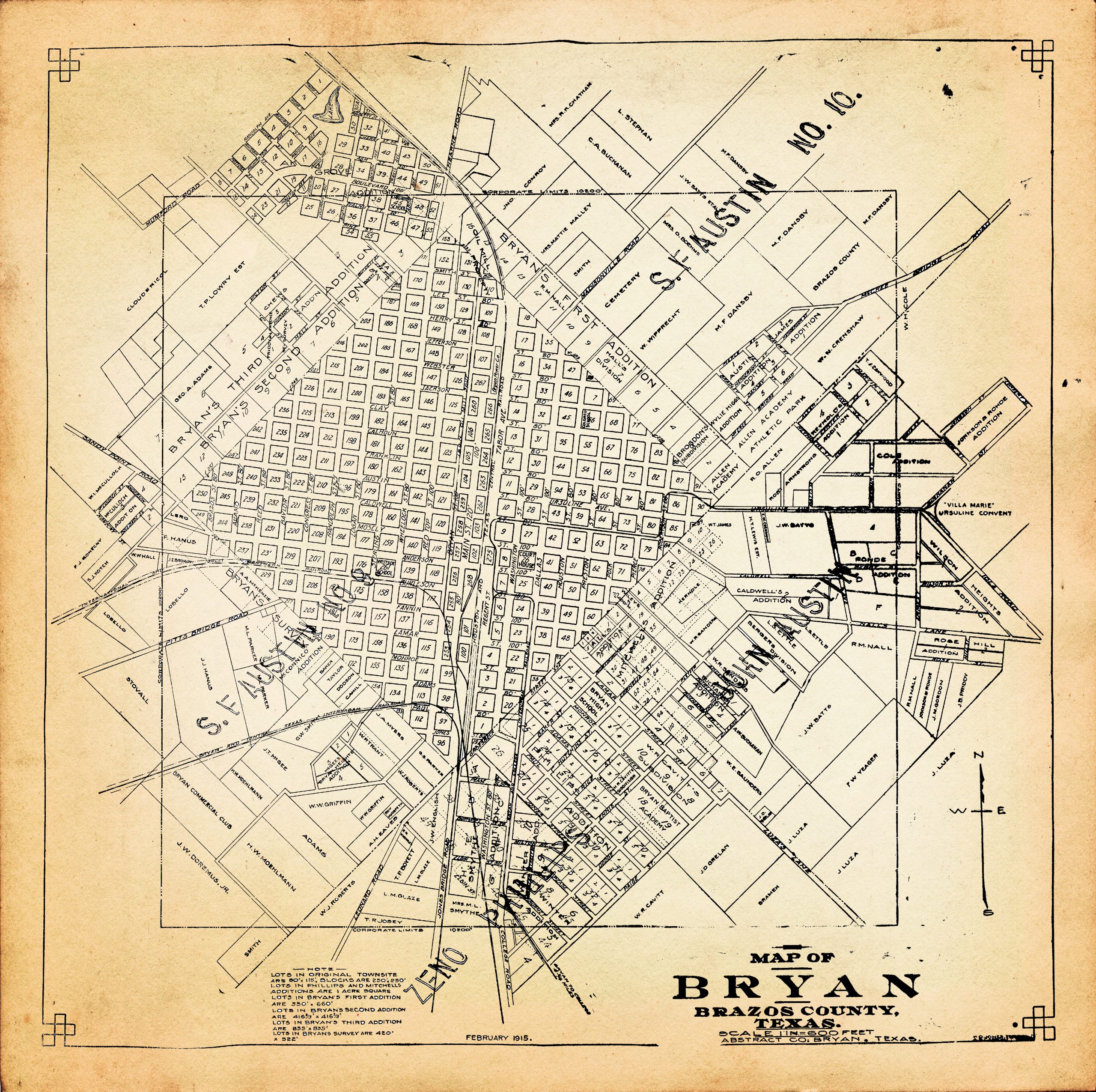
1915: Stylized digital copy of a map of the City of Bryan in 1915. This map shows the original Bryan townsite as well as the various other city additions and expansion that had occurred to this point in time.
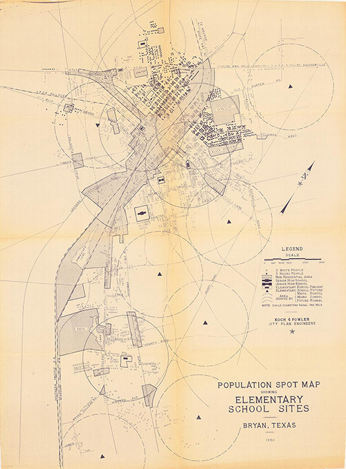
1950: Urban planning map of Bryan created by the engineering firm of Koch and Fowler for the City of Bryan in 1950.
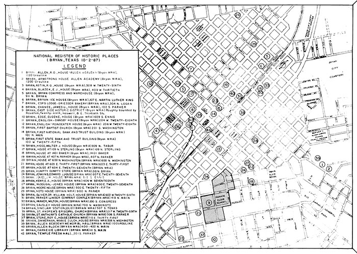
1987: Map of sites in Bryan that are on the National Register of Historic Places.
Other Informative Maps
Click on each map for larger image

Map courtesy of Fisk University, John Hope and Aurelia E. Franklin Library, Special Collections, Julius Rosenwald Fund Archives
1932: The Julius Rosenwald Fund Schoolhouse Construction Map. This map shows the number and density of 5,357 rural schoolhouses for African Americans that had been constructed by the Julius Rosenwald Fund as of July 1, 1932. About 13 of these these schoolhouses were constructed in Brazos County and the greater Brazos Valley region. Wayne Sadberry, curator of the Brazos Valley African American Museum, has a special connection to these schools. His father, Oliver Wayne Sadberry Sr., taught in one of these local Rosenwald schools.